Showing posts with label Case Studies. Show all posts

Friday, December 25, 2015

That 70s Urbanism, Part II: Fixing Urban Renewal

On Twitter, Cap'n Transit appreciated my focus on Stamford in the previous post, so to continue on the prior topic with an ongoing focus on the 1970s, I'll return to that city to offer some perspective on the past as well as some ideas for the future.

Best known as an office escape for New York-based banks and other companies, the city actually has a history nearly as old as New York itself and, before urban renewal, had a street pattern as intricate as lower Manhattan's old Dutch footways.  The New York and New Haven railroad cleaved the town in the late 1840s, and in the part south of the tracks polluting factories cropped up along the waterfront and canal.  In the 1950s, Interstate 95 ripped another path through the heart of the city, though partly following the railroad right-of-way.

Stamford's downtown in the midst of renewal, 1979. City of Stamford via Ferguson Library.
Finally, a massive urban renewal project, initiated in the 1950s but only carried out in full in the 1970s, destroyed the bulk of the city's downtown area and resulted in the demapping of many streets, even including the primary stretch of Stamford's Main Street.  These streets were replaced by high-speed "stroads," and the office buildings that replaced the fine-grained fabric of the city took the form of glass and granite monoliths perched over parking lots, serving as fortresses against the miasma presumably thought to be swirling on the near-empty sidewalks.  A large enclosed three-anchor mall was constructed over several blocks of condemned buildings.

Reworking 1970s Urban Renewal

The age of massive urban renewal on the scale that Stamford pursued is over, by and large, some planning projects in Baltimore excepted.  Stamford is unlikely to ever engage in another project of such scope.  As I noted in the previous post, however, a city like Stamford can still use those elements of 1960s and 1970s planning to its advantage if it plays its cards correctly.

The 1970s as I wrote were an early golden age of pedestrian infrastructure as reflected by several key elements which are broadly applicable to today's cause of walkability, although not all are today well-regarded:
  • Mass transit (obviously - the 70s witnessing a revival of heavy rail systems)
  • Generous use of elevators in public space
  • Escalators and moving walkways
  • Pedestrian tunnels, skyways and covered sidewalks
  • Pedestrianized streets
  • Enclosed malls and other shopping areas
In addition to the above, Stamford has in the last 20 years enjoyed a resurgence of the "Euro block" apartment form throughout the downtown area, in addition to an earlier boom in townhouse-over-garage condominium construction.  Although Stamford will not be Barcelona anytime soon, good things can be and should be happening, but the downtown is as car-dominated as ever.  How about a plan for incremental improvement?

The plan I put forward has several components, some inspired by Jane Jacobs, some by Jeff Speck, some by Nathan Lewis and Japanese city planning, and by others too numerous to mention:
  1. Extend the enclosed shopping area in the train station
  2. Narrow several of the downtown streets by sidewalk widening and use of bike lanes
  3. Use eminent domain and existing public land to open several new narrow streets
  4. Provide arcaded pedestrian streets where appropriate
  5. Open the mall to the street and re-open Main Street
  6. Use the under-capacity mall and Target parking lots for long-term parking for downtown residents in lieu of parking requirements
In most cases, new streets are built on existing public land and would require little or no condemnation.  Some simply represent streets which were uprooted and de-mapped during urban renewal.  Most vital to these is the continuation of narrow Summer Street down to the UBS building.  The street narrows to only about 16 feet at its southern extremity, and should be continued at that width further south, ideally as a shared space or even pedestrianized shopping street that will provide a safe and attractive walking path from the train station (a moving walkway probably veers too far into parody/Seinfeld territory).  As a 16' street, it could possibly be arcaded as well.  The street would terminate at the UBS building into an existing pedestrian pathway that leads to the train station.

This image, rotated counterclockwise, shows how the new street would appear lined by Euro block apartments and shops, leading with only a couple of curved turns directly to the train station, which has an existing underpass lined with a few shops passing underneath I-95.  This line of shops would be carried across past I-95 and along the path in front of the UBS building, possibly incorporating an anchor store:


Patching Up the Mall

In the previous post, I showed one way the mall could be opened to the street by demolishing one of the car access ramps:

At present, left, and after new entrance.
Additionally, entrances could be punched into the mall at various other points on the exterior, as most parking is actually above the mall, and shopping can be accessed at most points directly from the street.

Narrowing Other Streets

Atlantic Street, onto which this mall entrance faces, should be narrowed from three to two lanes throughout its length with a bike lane added.  A shared space arrangement with bollards (bollards inside the bike lane) would be an ideal treatment.  A new street of 16' or so (not shown) should be run past the facades of these buildings, through the adjacent park, under the mall and into the remnant stub of the old Main Street.  Half of the overly-large park (really a paved square) should be sold off to private parties to construct new buildings along the southern boundary of this new street, leaving a still-large triangular square bounded on all sides by rights-of-way.  

The city should also use its power of eminent domain to open new streets and to complete those discontinuous fragments that already exist.  The below map shows existing streets in red, pedestrian paths in orange, and suggested new streets in yellow:


These new streets also include a pedestrian bridge over Mill River at the upper left, the new 16' street referenced before curving through the park, a new arcaded street through the mall, and two streets creating a three-part division of a large, partly unbuilt block at the right.  Other segments have been added here and there, and the continuation of Summer Street is visible in the center right.

Transportation

Regarding transportation, despite the likely high cost, it may be desirable to create a second stop in downtown Stamford at either Canal or Elm Streets or along East Main Street.  This would help convert the train system into a small localized rapid transit system, and has parallels elsewhere on the line with New Haven's State Street station, Bridgeport's planned second Barnum station and Fairfield's Metro station.  

A full infill station, complete with station house, was built in West Haven for $80 million, though the Bridgeport's station's cost appears to be nearly double that.  Since Stamford is the last stop for many express trains, it would not unduly interfere with express train operation.  An Elm Street or East Main Street station serving the Cove neighborhood and providing a secondary downtown route might be very popular and would not require much parking.  There is ample room for it, and the existing overpasses dating from the turn of the century, will need to be replaced sooner or later.


Optimistically, a plan like this would have a ten-year time-frame from initiation of planning to start of operation.

Parking

Parking is always one of the thorniest issues in downtown planning, but Stamford, for better or worse, is "blessed" with an abundant supply of garage parking.  In particular, the mall parking lot and the Target parking lot are greatly under-used.  In light of this parking supply, if parking minimums cannot be abolished entirely, the city should offer fee in lieu of parking to any residential developer who secures a parking arrangement with one of these local operators.  The number of spaces required to be secured should be as low as politically feasible.

It goes without saying that on-street parking rates should be dramatically increased in the downtown area.  The city is currently attempting to raise additional revenue by imposing new fees on outdoor dining spaces, yet the parking adjacent to it continues to be greatly underpriced.  Although I am generally opposed to on-street parking in areas with high pedestrian volumes, a Shoup-inspired approach that used increased fees for civic improvements could be a positive change.

What Not to Do

Stamford is currently undergoing a major redevelopment project in the Harbor Point area, a former mixed industrial and residential area in the South End of the city, west of the canal.  Although purportedly the handiwork of planners, the haphazard arrangement of streets and commercial spaces creates an environment which at best, is reasonably pleasant, but which at worst is less than the sum of its parts.  

Here are some examples of the decent, the bad and the ugly.  One of the newest areas features a semi-shared space street (interesting) with use of bollards (good), yet the space is overly large (not good) the architecture is completely cold and indifferent (not good) and the scene is altogether too busy with too many plantings (not good).  There are a couple of restaurants along the street to the left with outdoor seating, which greatly helps to enliven the area in the warmer months.


For contrast, here is a street in between two apartments, lined with garages and electric equipment.  This is an unpleasant and even dangerous street to walk down, and it is right off the main park square!


Most unforgivably, in another area close by, is this facade on the local neighborhood commercial main street.  I generally try to steer away from strong language so that readers may make up their own minds, but this is simply atrocious.  The street level must be done better than this.


There are many other changes large and small that one could consider throughout Stamford as a whole, and the city does seem to be engaged in a process of gradually narrowing intersections by bumping out sidewalks, thereby improving pedestrian safety.  With several recent and well-publicized deaths of pedestrians, this needs to be an immediate focus and priority.  Zoning needs to be reformed as well, but that is a post that I have already written.

Wednesday, December 9, 2015

Urban Governance: Merger and Fragmentation

Let's consider two hypothetical cities. For convenience, I'll call them "Hartford" and "Nashville."  Both are state capitals.  Both are favorably located on bluffs overlooking large rivers and are surrounded by abundant buildable land.  As of 1960, both cities proper had comparable populations, with Hartford at 162,000 and Nashville at 170,000.  Hartford was in 1960 by far the wealthier of the two, being located in one of the richest states of the union and hosting the headquarters several of the nation's largest insurance companies, yet housing costs were reasonable in relation to Boston and New York.

From the standpoint of a 1960 observer, Hartford appeared to have the brighter prospects for population growth.  Hartford's metropolitan area, represented by the county of which it was the seat, was in fact growing at a more rapid clip than Nashville's Davidson County, with a population increase of 28% during the 1950s compared to 24% for Nashville, even though Tennessee at the time had a higher birth rate than Connecticut and Davidson was absorbing heavy in-migration from much of the central Tennessee region.

Around 1960, however, two developments reshaped the governance of both cities.  In that year, Connecticut's abolition of county government went into effect, leaving only the state government and 166 town governments, one of which was the rump city of Hartford, a jurisdiction of 17 square miles.  Only three years later, Nashville moved in the opposite direction, merging itself with the 504-square mile Davidson County and forming a consolidated city-county government.

Since 1960, Hartford County has grown 23%, while Davidson County has grown 40%.  By 2010, Nashville's urbanized area population exceeded Hartford's.  As of 2014, Davidson County with 668,000 inhabitants held fully 62% of the greater Nashville urbanized area population.  By contrast, the city of Hartford had lost population since 1960, and with only 125,000 residents held only 13% of the greater Hartford urbanized population.  Nashville's downtown area is today booming with apartment construction, while Hartford has seen little multifamily development since the 1960s.

The factors in the success of Nashville relative to Hartford obviously are more complex than the arrangement of city government, and involve developments as varied as the economic rise of health care and higher education and the general increase in prosperity in the American south relative to the nation during the mid and late 20th century.  Nonetheless, the relative fragmentation or centralization-by-annexation/merger of city governments is of major importance in how cities are run, regulated and taxed.  For instance, consider that a home in Hartford today bears a tax burden more than three times that of a home of identical value in Davidson County.

For the 2010 Census, the list below shows the top and bottom 15 rankings for the population of cities proper expressed as a percentage of total urbanized area population (out of the top 50 largest urbanized areas):


The list of metros with the highest percentages of their urban population contained within their cities includes several of the fastest-growing and most economically resilient cities in the United States: of Brookings' list of the top 10 performing cities over the past several years, five are on this list.  Only one metro on Brookings' list, Salt Lake City, appears on the bottom 15.

Simply because a metro appears on the low end of the rankings, however, does not necessarily mean that it is highly fragmented overall.  Washington D.C., for instance, is surrounded by large and relatively powerful county governments, including Fairfax (1.1 million, 407 sq. mi.), Montgomery (1.0 million, 507 sq. mi.), Prince George's (890,000, 598 sq. mi.), as well as the smaller but populous Arlington County and city of Alexandria.  Others, such as Bridgeport, CT, Providence, RI and St. Louis, MO do have a highly fragmented governing structure throughout the metro area, with a large number of small towns each guarding their own local taxing and land use prerogatives.  County governments fractured into townships tend to replicate, in approximate fashion, the metro areas of non-county states such as Connecticut and Rhode Island.  The proportion of people living within the central jurisdiction is suggestive of degree of fragmentation, however.

I can hear the reader say right now: but correlation isn't causation!  While that is certainly true, and while I also bear in mind Jane Jacobs' comment that a region "is an area safely larger than the last one to whose problems we found no solution," those who have studied this issue have found definite advantages to a more centralized form:

  • Zoning.  Although one might imagine that a multiplicity of jurisdictions might compete with each other for residents, thereby raising the net quality of life, what is observed instead is that jurisdictions attempt to compete for wealthy residents by imposing restrictive zoning regulations.  This results in a zoning race to the bottom, as towns enact ever-stricter regulations to keep prices high.  The result is high citywide housing costs relative to income.  More centralized cities tend to have more permissive zoning.
  • Property Taxes.  A highly fragmented metro tends to have high property taxes as well, due to lack of economies of scale.  Central cities often suffer the most, as they have the largest share of public or non-profit land, and must impose nearly ruinous taxes on the remaining devalued private land to cover basic municipal services.  The taxes further drive down property values, resulting in a situation where (as with Hartford, see below), the situation nearly becomes unsustainable.
  • Education.  As I've written about before, overall educational outcomes in county-wide educational systems funded out of general revenues can be as good or better than even the best and most lavishly-funded local school systems.  
  • Transportation.  In general, regional transportation planning would be expected to have a smoother political course in a centralized city.
There are disadvantages too.  Very local governments, for better or worse, can be (or at least are perceived to be) more accountable to the individual citizen.  These governments may have long histories and impart to an urban area much of its character.  Some of the advantages of the centralized form can be overcome through adopting elements of a centralized form, such as pooling of certain services, without relinquishing all local authority.  

Still, where all else fails, consideration of more drastic measures may eventually become necessary.  In its election just a month ago, Hartford elected a new mayor, Luke Bronin, who defeated the incumbent in an earlier primary.  Although the local paper has wished him well, it closed a post-election op-ed with words that may soon need to be uttered more forcefully:
"The steep challenges facing Hartford and Bridgeport [which also elected a new mayor] raise the question of whether these cities, which have heavy costs and little property to tax, can continue to be viable. The canary in the coal mine on that may be New London, where Democrat Michael Passero, a city council leader and former firefighter, was elected to replace Mayor Daryl J. Finizio.

At seven square miles, New London is the second smallest geographical municipality in the state. Like Hartford and Bridgeport, it bears a disproportionate amount of its region's social costs. 
If the new mayors cannot make these cities work, we shall have to rethink them."
Whether Connecticut has the capacity to "rethink" the organization of its centuries-old towns is a reasonable question, as is the question of whether any such reorganization would work to solve central city ills.  That the question is presenting itself at all, however, is indicative of the scale of the problems at hand.

Saturday, October 4, 2014

Housing Innovations in Texas

Citylab recently posted an interesting profile of a new development in Harlingen, Texas by Amanda Kolson Hurley.  Having written about this area of the country earlier this year, I was curious to take a closer look at the development, which appeared to take some design cues from the Mexican urbanism that is just a short ride away from this border region.

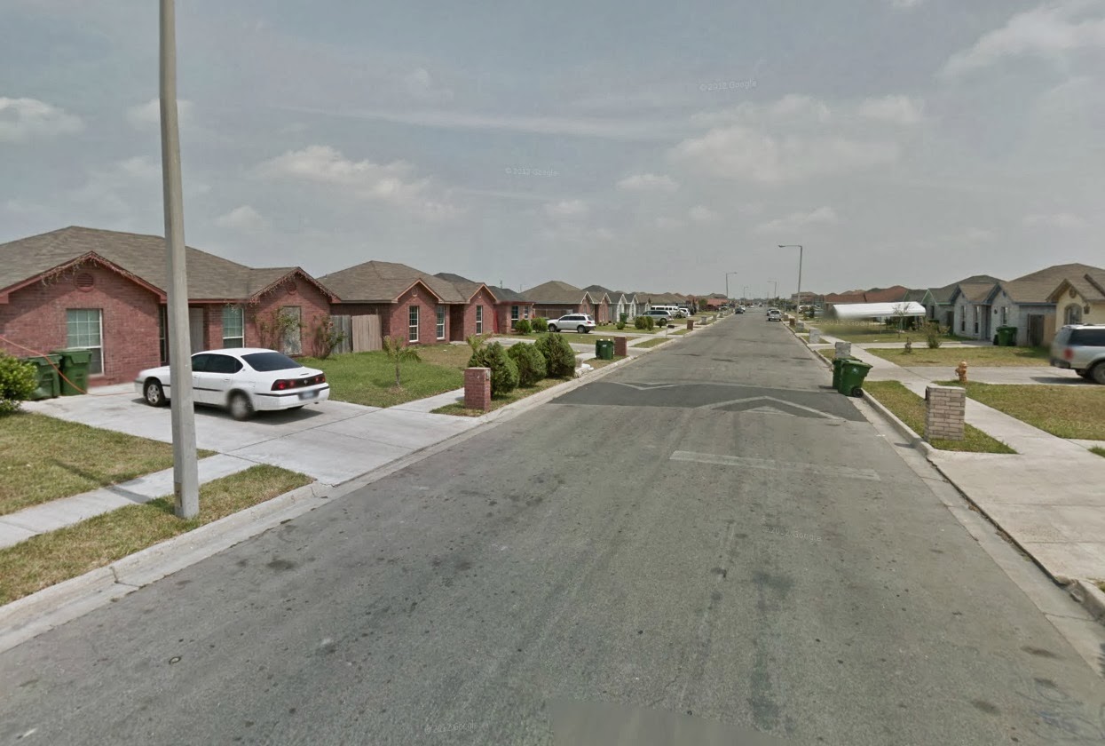
An aerial view of the development, La Hacienda Casitas, shows it set among mobile home parks that are very common in Harlingen.  These homes, however, are site built, and use lots as small as 1,800 square feet, which is similar to the lots sizes found in the new developments of Matamoros, Mexico.  Streets range from 16 to 22 feet wide, with some on-street parking:


The more I looked around Harlingen, the more this particular development stood out: overwhelmingly, new development in the city consists either of mobile home parks or much larger suburban homes of the type found in sunbelt cities across the United States.  It was a pattern I'd seen before, in Bradenton, Florida, where the city's zoning code divided single-family housing into two types: large lot, site-built suburban and small-lot, manufactured and/or mobile.  Could land use in Harlingen be governed by similar provisions?

Fortunately, the city puts its zoning ordinance and map online in an easy-to-navigate format, so finding residential lot minimums was not difficult:


Here we see that Harlingen, like Bradenton, establishes a minimum lot size for lots in mobile home parks that is less than half that required in the single-family "R1" zone.  In fact, the ratio between the two zoning categories is nearly the same in both cities (Harlingen: 6000/2400 = 2.5 vs. Bradenton: 7200/3000 = 2.4).  Unlike Bradenton, Harlingen does not seem to establish minimum sizes for the dwellings themselves, although setback and lot coverage requirements impose effective maximums that are most restrictive on very small lots.

How well the city holds developers to the limits I cannot say for sure, although most lots in developments platted within the last 20 years appear to be between 6,000 and 7,000 square feet. On first blush the "Planned Development" zone appears to provide some flexibility, but it requires the developer to own a parcel of at least five acres, leaving it unavailable to small-scale builders designing infill projects.  Townhouses are also an option, but are not permitted by right in R1 zones.

In any event, the disparity between zones again appears to create a binary pattern of real estate prices, with new site-built homes on large lots averaging around $145,000, and manufactured homes only $45,000 or so.  Thanks to zoning-abetted filtering*, some site-built homes can be bought for no more than $60,000 to $70,000, but these tend to be of very low quality or on much smaller lots that seem to have been grandfathered in under the present zoning code.  This mandated land consumption obviously contributes to a low-density pattern of urban growth, and also illustrates how zoning's affordability and quality of life impact isn't limited to large coastal metros.  Harlingen's affordability safety valve, the mobile home district, establishes what is in effect a physically segregated zone for low-income, market-rate housing where even the homes themselves are forbidden from being site-built.

Homes in La Hacienda Casitas. Credit: bcWorkshop.
In light of all this, was the La Hasienda Casitas project an attempt to circumvent the code with a development of houses on tiny lots and narrow streets, thereby making occupancy (the homes appear to be rentals, at least for now) of new, freestanding and site-built homes available to low-income families of Harlingen?  Kolson Hurley's article discusses the intensive coordination and grant-seeking between and among architect bcWorkshop and non-profit housing developer Community Development Corporation of Brownsville needed to bring the project to fruition, but I have to wonder whether regulatory barriers, rather than anything inherent in the design and construction of this project, is what is standing in the way of adoption of the style by for-profit developers.


*Zoning-abetted in that the restriction of centrally-located lots to single-family use effectively caps land values, allowing the physical deterioration of the housing stock to play the predominant role in establishing property values.

Related posts:
Mobile Home Impediments and Opportunities
Cross-border Urbanism: From Texas to Tamaulipas

Tuesday, April 22, 2014

NYC Suburban Demographics: Choice or Fate?

The New York Times recently profiled a study from Community Housing Innovations which noted a demographic collapse among the young adult population in the wealthy suburbs of Long Island and Westchester County since the 2000 Census. The decline is attributed largely to high housing costs rather than an immutable preference for urban surroundings:
"The villages and towns suffering the largest losses of their young workforce have historically restricted multifamily development in favor of single-family homes. The practice, known as exclusionary or snob zoning, makes living in these communities unaffordable for much of the Long Island and Westchester County workforce."
The study paints an interesting picture of the unintended consequences of restrictive zoning, which in this case may be hindering adults at a prime age for starting a family (25-34) from living in what, in many cases, are probably the very same towns they grew up in. Although the Times quotes a Westchester County source disputing the figures and noting that the "county’s own enrollment data shows that more children are attending its schools, a telling sign of young families," a glance at the Census figures reveals that the under-5 population in many of these towns is plummeting as well.

For instance, while Westchester County saw a decline of 11% in this group from 2000 to 2010 despite experiencing overall population growth, Scarsdale's under-5 population fell by 28%. Jericho, New York, mentioned in the article, also saw a decline of 27%. For further comparison, here are the figures for part of nearby Fairfield County mapped over median housing prices:


These can be compared to the same figures for the 25-34 population:


Although the numbers don't match up precisely, the correlation is strong. There is an overall decline of around 10% in both population groups, compared to an increase nationally of 3% for both, but there has been a rapid assortative process as young families have apparently been priced out of many locations and restricted to the few remaining jurisdictions, which include the urban markets of Stamford and Bridgeport, without stratospheric housing costs.

Whether this is also due to a preference for urban living conditions is unclear, since the urban markets also happen to be the low cost markets, and are the only places in Fairfield County permitting the construction of significant quantities of new housing. The fact that population loss of these demographics was somewhat less in relatively more affordable suburban towns (such as Fairfield or Trumbull) suggests that cost is at least as important a factor, a pattern which is also noted on Long Island in the New York Times article.

The overall losses among the 25-34 age group indicate an accelerated outmigration in addition to the internal assortative process. The study cited by the Times suggests, in the vein of the Great Inversion, that this migration is a product of relocation to New York City proper, and to particular areas within the city, although many must be leaving the region entirely. In this broader context, though, I'm not satisfied with a sample period of only ten years and certain areas, and so I compiled median age data for the greater New York area from 1970-2010, dividing it into three regions*:


Although there is certainly a great inversion here, it appears to be a multi-decade process, rather than an sudden shift which occurred over the last ten or fifteen years. These trends can also be expressed as a function of the US median age in each Census period so as to show which regions were growing "younger" or "older" relative to the population as a whole:


Rather than the city abruptly changing course in recent years, a long term downward age trend actually decelerated after 2000. Trends have not always been consistent, with the inner suburbs actually growing relatively younger from 1970 to 2000. The continued aging of the outer suburbs is also notable. Several counties in this region now exceed a median age of 40, with individual towns highly coveted for their excellent public schools exceeding a median age of 45. These median age figures in some cases approach or exceed those of Florida counties known as retirement havens (cf. Westport, CT, at 44.6, with Palm Beach County at 43.5). With little new construction and limited housing turnover, combined with greatly elevated prices, these towns await a generational shift.

Just how big will that shift be? The Westport town newspaper, at it happens, suggests dramatic changes after 2015. According to one quoted source, "there's going to be major turnover in property. People who currently own homes and have for a long time, are going to decide to downsize. When turnover does occur, you'll get a flood of students entering elementary school." 

The problem for towns such as Westport, however, is that due to their resolute opposition to any new construction – even including senior housing, as described in detail in Snob Zones – there are not many options to downsize to. It seems more likely to me that the inhabitants of these homes will, by and large, remain in them to the end, as they will generally be unwilling to abandon their towns and long-established connections simply to find smaller accommodations elsewhere. The turnover point is therefore more likely to be in the 2030s than by 2020, but this will obviously come too late for the Boomer generation's own children seeking to start families. It's also not clear, given the widespread declines in the under-5 demographic, where a "flood" of new students could come from several years down the road.

An apparent denialism about the effect of high prices on young families seems to be rampant among many of the wealthy towns profiled in the CHI study and in Fairfield County. Wishful thinking about floods of new students that are just around the corner, or analysis of falling school enrollments that fail to diagnose high housing costs as a contributing factor, rules out consideration of the supply-based solutions that have apparently worked to some degree to retain young people in certain Long Island suburban towns discussed in the CHI study. These towns need not be victims of fate, but unless changes are made, their futures are already inscribed on their current demographics.

-----------------------------

Related links: Remember this New York Times article from 2013 covering young families moving out of Brooklyn to suburban towns in Westchester County? As it turns out, Brooklyn experienced a decline in its under-5 population from 2000 to 2010, but only by 3%. Hastings-on-Hudson, by contrast, saw that group decline by 19%.

*By county, "Urban" = Manhattan (New York), Bronx, Brooklyn (Kings), Queens, Hudson; "Inner Suburban" = Westchester, Nassau, Bergen, Union, Passaic, Staten Island (Richmond); "Outer Suburban" = Suffolk, Fairfield, Rockland, Morris, Somerset, Middlesex, Monmouth. Exurban counties are omitted.

Sunday, February 23, 2014

Cross Border Urbanism: From Texas to Tamaulipas

Although the American and Mexican urban traditions have at various times shared some fundamental similarities, including a heavy use of orthogonal grids and an apparent tendency toward single-family homes sitting on their own lots, the different manner in which these have been carried out in each country have produced strikingly dissimilar urban landscapes.

Nowhere is this more evident than with the sister cities of Brownsville and Matamoros, facing each other across the Rio Grande river. Demographically and economically they have much in common: the 2010 Census indicates that over 85% of Brownsville's population is of Mexican ancestry and Spanish-speaking, and although Brownsville is wealthier than Matamoros, it is very poor by American standards, having recently replaced McAllen as the poorest city in the nation. The Mexican state of Tamaulipas, by contrast, is wealthier than the Mexican average.

Matamoros at left, Brownsville at right. From Google Maps.
The economic and demographic convergence at the border might suggest a gradual transition in urban form, but instead there is abrupt break at the Rio Grande river, as can easily be seen above (the map has been rotated clockwise). Matamoros is a city that makes almost exclusive use of attached or nearly attached dwellings on small lots, while Brownsville has a quintessentially American pattern of detached houses sitting on much larger lots.

A typical house lot in a newer neighborhood of Matamoros has only around 1200 square feet, while in Brownsville, new subdivisions have lots around 5400 square feet. Interestingly, the lot size trends appear to be diverging: Matamoros' new lots are smaller than those in older parts of the city even as car ownership has soared, while Brownsville's are much larger. Older areas of both cities, dating back to the late 1800s or early 1900s, both tend to have house lots of around 3,000 square feet, although in different configurations (Matamoros, for instance, never used rear alleys).

Contemporary subdivision street in Brownsville. Google Maps.
New homes in Matamoros are often tiny, in some cases little more than 500 square feet, but appear to be mere placeholders for expansion. Usually set back about 15-20 feet from the lot line, these homes are swiftly expanded forward into the setback and up a story or two using simple construction techniques, with the result that after no more than a decade or so, the street's appearance is completely transformed, and no longer appears mass-produced. (Single-use zoning seems to be unknown or unenforced, as numerous small commercial establishments can be seen cropping up, mid block, along these streets.)

Mexican "snout house" in Matamoros, expanded from the developer's
original house of the type still visible to the right. Google Maps.
Expanded in this way, a very small home can grow to perhaps as much as 1000-1500 square feet. Persons desiring even larger homes could, presumably, simply buy adjoining lots and combine them.

This fundamental difference in lot size has major implications for the size of the urban area. Matamoros, with a 2010 population of 489,000, actually occupies slightly less area (28 sq. mi.) than Brownsville's 175,000 (29.9 sq. mi.), based on a mapping out of residential urban boundaries in each case. It also must have some implications for home prices: while Brownsville homes are much cheaper than the American average with a median home price of $130,000 for what is typically a three bedroom home, a relatively large Matamoros starter home (915 square feet over two stories on an 1130 square foot lot) can be had for only $34,000. The tiniest of the starter homes, no bigger than a studio or micro-apartment, are as little as $10-15,000. This suggests that a new two-bedroom home in Matamoros can be purchased for approximately what the down payment would be for a typical three bedroom home in Brownsville, and helps explain Mexico's very high homeownership rate. Finally, it has implications for mixing of uses, since the dense packing of houses allows for businesses to thrive on foot traffic, reducing the political pressure for parking minimums that would, even in the absence of zoning, effectively ban businesses on tiny lots.

The economic, financial, geographic, historical, cultural and legal factors that have led to such divergent patterns of urban growth aren't easily or quickly summarized, but the different outcomes are clear enough.

Related posts: Check out Apex Urbanism, which has a series of posts featuring various Mexican cities.

Sunday, January 26, 2014

The Zoning Straitjacket, Part II

Shane Phillips (at Better Institutions), Dan Keshet (Austin on Your Feet) [update: and Daniel Kay Hertz, at City Notes] both recently authored posts showing how the majority of the area in three large American cities (Seattle, Austin and Chicago) is set aside for single-family detached zoning. Shane estimates the area in Seattle to be around 80%, while Austin, to my eye, looks to be about the same. In general, the zoning maps continue to reflect the land use patterns and planning dogma of the 1920s, with a small, constrained downtown business district hemmed in by single-use residential districts through which snake narrow commercial corridors. This is the same pattern I previously noted in the case of Vancouver, where the zoning map is surprisingly unchanged from the original version drafted in the 1920s (however, Vancouver has only 60% of its zoned area set aside for single-family, and has allowed more density in these areas as well).

Although I've made several arguments against Euclidean zoning before, if a city is to be zoned, I don't think there's anything wrong in and of itself with having detached single-family zones — America's unique contribution to zoning, according to Professor Sonia Hirt — as one of a city's planning tools. The issue seems to be that these zones, and particularly low-density zones, are virtually impervious to change over the decades. Where a city has abundant greenfield land for expansion, this is somewhat less of a pressing concern, but consider a city like Stamford, Connecticut, which exhausted most of its undeveloped territory back in in the 1970s, and is bordered by insular Greenwich and Darien (the latter of which inspired Lisa Prevost's Snob Zones). At left is an image of the zoning map from 1965 (14 years after its initial adoption), and at right is today's map:

Sources: City of Stamford and Ferguson Library Digital Collection.
Although the total number of zones has more than doubled, going from 17 to 39, the major zoning boundaries in the north of town are entirely unchanged. In 1965, as today, approximately 80% of the city was zoned for detached single-family residential. Nonetheless, according to ACS data, only around 40% of the city's housing units consist of single-family detached (SFD) units, which highlights the prevalence of large-lot zoning in the single-family areas (the yellow areas represent 1, 2 and 3-acre minimum lot sizes), and the near-impossibility of adding any further SFD under the current zoning regime.

Population by city proper, from Census data.
For Stamford, this zoning policy, which was less a planning vision than a "paint by numbers" exercise in locking into the place the loose residential patterns built along the non-gridded street networks that were being laid out by land companies as early as the 1930s*, worked to accommodate population growth for a time. While there was still vacant land in the north, the city's population surged from 1950 to 1970, just as other established cities like Bridgeport and New Haven stagnated or lost residents. The exhaustion of this supply of land, paired with an immensely destructive urban renewal project in the early 1970s that virtually obliterated the city's entire downtown (and along with it, much of the city's low-cost attached and multifamily housing stock), resulted in a sudden reversal of fortunes in the 1970s. Most of the gains since 1980 have occurred through infill and densification in the existing downtown and multifamily areas, although this has been a slow process. In the 2000-2010 period, in fact, New Haven grew faster than Stamford for the first time in at least 130 years.

The SFD zones have therefore played a role strongly reminiscent of Smart Growth urban growth boundaries, requiring additional housing units to be built in already-dense, transit-accessible areas, although the establishment of the zones predated Smart Growth ideology by several decades. However, Smart Growth critics like Randal O'Toole and Wendell Cox have never, so far as I know, gone after large-lot SFD zoning for restricting housing supply in geographically-constrained situations like this one [Note: in the comments, NickD points out that Cox has criticized large lot zoning, although often without much specificity]. O'Toole has even gone so far as to condemn upzoning of SFD areas on several occasions on the basis that these zoning changes are out of "character" for the area, and frustrate residents' expectations, observations which inadvertently highlight the growth-restricting role of these areas.

The ideological battle between Smart Growth advocates and the self-appointed defenders of the American dream obscures the real functional purpose of maintaining a reasonably clear break between city and country, which, in the United States at least, could be said to be permitting unencumbered and politically-frictionless urban expansion. The city which, like Stamford, forces new development to spread across large areas at very low density is, in effect, politically closing that area off to urbanization and possibly even modest densification in a way that urban growth boundaries, which can and are periodically adjusted by city and state governments, cannot achieve. Moreover, it makes it uneconomical to produce much additional SFD housing, a result that should be highly distressing to someone like O'Toole. It is an approach which seemingly leaves both sides dissatisfied.

This, if nothing else, seems like a fundamental, if not the only, purpose and challenge of city planning: accommodating population growth in a way that takes into account long-term development prospects and the political difficulty of upzoning low-density SFD areas. In light of this, can a zoning code like Stamford's, with a stated purpose of preserving existing neighborhoods in their 1960s form, and resistant to all but changes in the downtown area, really be called a "planning" document at all? The challenges that Stamford faces are not unique, but typical, and progress on them, as zoning approaches its 100th birthday, remains the exception rather than the rule.

Related link: Vancouver and the Zoning Straitjacket

*Historic aerial maps show that Stamford's urban grid was disintegrating as early as the 1930s, just before its major population boom, and that subsequent rights of way were generally winding and given non-urban descriptors ("Road" rather than "Street"). In other words, it appears that the city ceased taking a prominent role in guiding the framework for urban growth around that time. The zoning code did not cause this change, but it certainly has prevented any future adaptations or retrofits. Chris Bradford noted a similar change in Austin that took place at around the same time.

Sunday, June 30, 2013

Common Garage Parking in Practice, Part III: On-street Problems

Norwalk, Connecticut was facing parking problems. Although it had recently built a 775-car parking garage to serve its popular South Norwalk (SoNo) district, a formerly derelict collection of 19th century warehouse, commercial and factory buildings now revived as a bar, restaurant and shopping district, complaints continued to pour in from visitors and proprietors that the area lacked sufficient parking.

To a disinterested observer, these complaints might have seemed odd: the modest row of shopfronts along Washington and Wall Streets were surrounded by off-street parking and had ample on-street parking as well, and the blog Livable Norwalk confirmed that the SoNo area in fact did have an ample supply of parking in the vicinity:
 
From Livable Norwalk: public parking in blue, private in orange.

In spite of the purported lack of parking, the new garage (located a five minute walk from the heart of the area) was a target of particular ire from local restaurant owners, who complained that it was too far away for customers. Several attempts have been made to explain the lack of use of the new multi-million dollar garage in spite of persistent griping about insufficient parking, including:
  • A pricing structure that would give Donald Shoup nightmares. Norwalk charges dramatically more for its garage spaces than for on-street spaces, even though the on-street spaces are scarcer and more convenient. Moreover, the city makes on-street parking free during high demand hours (after 6 p.m. for most streets), while only discounting garage parking. In response to this situation, the city recently hiked prices at its garages while leaving metered spaces unchanged.
  • A poor pedestrian experience. One blogger posted videos to show the allegedly poor quality of the short walk from the garage to the center of the restaurant area, despite the fact that the garage incorporates a retail and office liner around most of its perimeter.
  • An excessively long walk. This is the claim of SoNo merchants and visitors alike regarding the five-minute walk from the garage to Washington Street, although for certain attractions (such as the Maritime museum and a few restaurants) the garage does represent the closest parking option. On-street parking is very limited in the immediate vicinity of the garage.
All of these explanations must play some role here, but one that is unmentioned is, I think, perhaps the most important of all: the presence of on-street parking itself.  Consider the nearby Stamford Town Center, a typical enclosed mall which is reached solely by paid garage parking. A typical visitor will need to walk about three to five minutes to reach a randomly-chosen store from the garage, and possibly as many as seven minutes to reach certain parts of the anchor stores. Yet there's rarely if ever been any complaint raised, so far as I'm aware, that parking is too far from the mall's stores, that that there isn't enough of it, or that the walk through the dim garage is too unpleasant.  

Glance again at the map above, showing the commercial thoroughfare of Washington Street running east to west at the center of the frame. Occupying the entire southern half of the southern block, outlined in blue, is the 265-space Haviland Street parking deck. To the north is the 775-car Maritime Garage. Washington Street itself offers only 22 spaces, in comparison to the over 1,000 public garage spaces in close proximity, plus many hundreds more in public and private surface lots. Although these spaces only supply a tiny fraction of the total, by their conspicuousness they play an outsized role, inducing many motorists to circle the block several times in hopes of winning the parking lottery, rather than simply proceeding to one of the garages.

From a performance parking perspective, one could suggest charging for these spaces at the market-clearing rate, but taking a contextual view of Norwalk's parking policies, that may almost be beside the point. The very existence of the parking spaces, regardless of their cost, exacts a psychological toll on would-be garage parkers by making their walk seem long relative to where, in theory, they might have parked. As long as the spaces exist, garage parking will always be seen as a second-best option. At the mall, by contrast, where the option of parking in front of one's desired destination is completely unavailable, shoppers are indifferent to longer walks and seem to endure them without much complaint.

From the perspective of the merchants, often the biggest boosters of underpriced on-street parking, this apparent drawback of on-street parking is in fact seen as its very benefit. Since shoppers are believed to be tempted by abundant free parking in other shopping areas, the retention of very cheap or free and convenient parking may be seen as essential to create the illusion, for motorists, of the same commodity found in suburban shopping centers (this sentiment is captured well in this article).

That this commodity is not available to 95% of peak-hour visitors regardless of how it is priced is irrelevant, given the same factors at play (that is, the theoretical possibility of a cheap, convenient spot is presumed to carry disproportionate weight in the mind of the potential shopper: the goal is luring them in, rather than actually providing them with the commodity sought).

How to reconcile all of these competing views, which have produced a parking policy that is at war with itself, pitting alluring on-street parking against the city's own garage parking, and cheap, scarce spaces against abundant, expensive spaces – a situation hardly unique to Norwalk? Well, there are several potential options apart from adjusting the pricing structure:
  • Convert the parking lane to sidewalk space. Although New Urbanists generally oppose the elimination of on-street parking, this is generally in the context of effective street widenings, in which the lane is turned over to through traffic rather than pedestrian use. Repurposing street parking for non-automobile uses (a favorite intervention of tactical urbanists, those deconstructivists of the autocentric paradigm), on the other hand, ought to be seen as a positive intervention.  Spanish cities frequently incorporate shared-space streets with through-traffic lanes, and with parking prohibited through use of trees and bollards (see at right, from Barcelona).  There is no reason such an approach could not be used on a much wider street, leaving ample room for sidewalk dining.
  • Total pedestrianization. Another option frequently derided on the basis of several conspicuous failures in the 1970s, pedestrian malls have actually enjoyed tremendous success in dozens of American cities (non-American examples are too numerous to mention). Limited vehicular access for deliveries during certain hours would preserve functionality without unduly detracting from quality of life.
  • Unconventional approaches to parking re-use. In a recent post, Matt Yglesias suggested that one way to deal with residents' fears of spillover parking generated by new development might be to eliminate residential parking permits and deed on-street parking spaces over the adjacent homeowners. Given that merchants would more likely than not be strongly opposed to either of the previous suggestions (but not always -- see an example of Minneapolis restaurants supporting a sidewalk expansion into street parking here), the same approach could be used in a commercial context. Establishments would be free to use the on-street space for their own parking, for some other use, or could simply sell the rights to the space to another merchant. 
In a new development, at least, one would hope that these knotty, politically divisive issues could be dealt with in a comprehensive, consistent and economically rational manner, yet at the planned Waypointe mixed-use development north of SoNo, renderings and promotional videos appear to show on-street parking despite the presence of a 1025-space parking garage (incorporated Texas doughnut-style).  Even if no such parking is actually part of the formal plan, the ample width of the carriageways implies, and will likely result, in their eventual presence.


Related posts:
Common Garage Parking, In Practice
Common Garage Parking, In Practice: Part II
 

Friday, March 9, 2012

Common Garage Parking, In Practice

In the comments to the previous post, Nicolas Derome linked to an interesting residential development outside Toronto (very close to a major planned DPZ project) which appears to have adopted the garage-parking-under-square approach.  Google's streetview has covers this development, allowing you to explore it on your own, but in the aerial view below the essential elements are all visible:

The two large, curving ramps in the center square lead down to the garage.  Throughout the development, stairways lead from sidewalks directly into the garage area.  There is no above-ground garage parking (with all the aesthetic and space-saving benefits which flow from from that),  although there are a handful of on-street spaces.  Streets are 30 feet from curb to curb in most places, although one street, designated as an emergency access lane, is only 14 feet with no sidewalk.

The design is very much Garden City, resembling a somewhat denser Radburn (or any one of dozens of low-rise American public housing projects) with segregated paths for automobile and pedestrian traffic.  In the absence of any use but residential, there is no pretense of urbanism here.  Without places to walk to, the advantage gained by stowing the cars underground is not exploited. 

Could a similar design be adapted to traditional urbanism?  I've shown the example of Bastia, or a larger city such as Mannheim, or Savannah, but in each case the underlying theme is simply moving the built elements closer together, whether in a grid or in a more organic layout:


Would any attempt to integrate garage ramps into a dense urban environment fall victim to "overblown traffic engineering and design codes," as Marc mentions in the earlier comments?  It is difficult to imagine anything as modest and and sensitive as the Bastia and Mannheim examples being allowed in the United States, but this Canadian development shows at least that it can be an economically viable design approach.