Friday, January 27, 2012

Friday Read: Mixed-Income Housing, Prussian-Style

In the response to Wednesday's post, commenter Marc mentioned the example of the Mietskaserne (roughly, "tenement"), the mid-rise courtyard apartment blocks that were built in the tens of thousands throughout central Europe during the 19th century.  Europe's answer to the tenements of the Lower East Side, the designers of these apartment buildings attempted to accommodate density with a degree of open space and residential with commercial and industrial uses.  Notably, they even aspired to integrate the wealthy with the poor and middle-class, all within the same buildings or cluster or buildings.

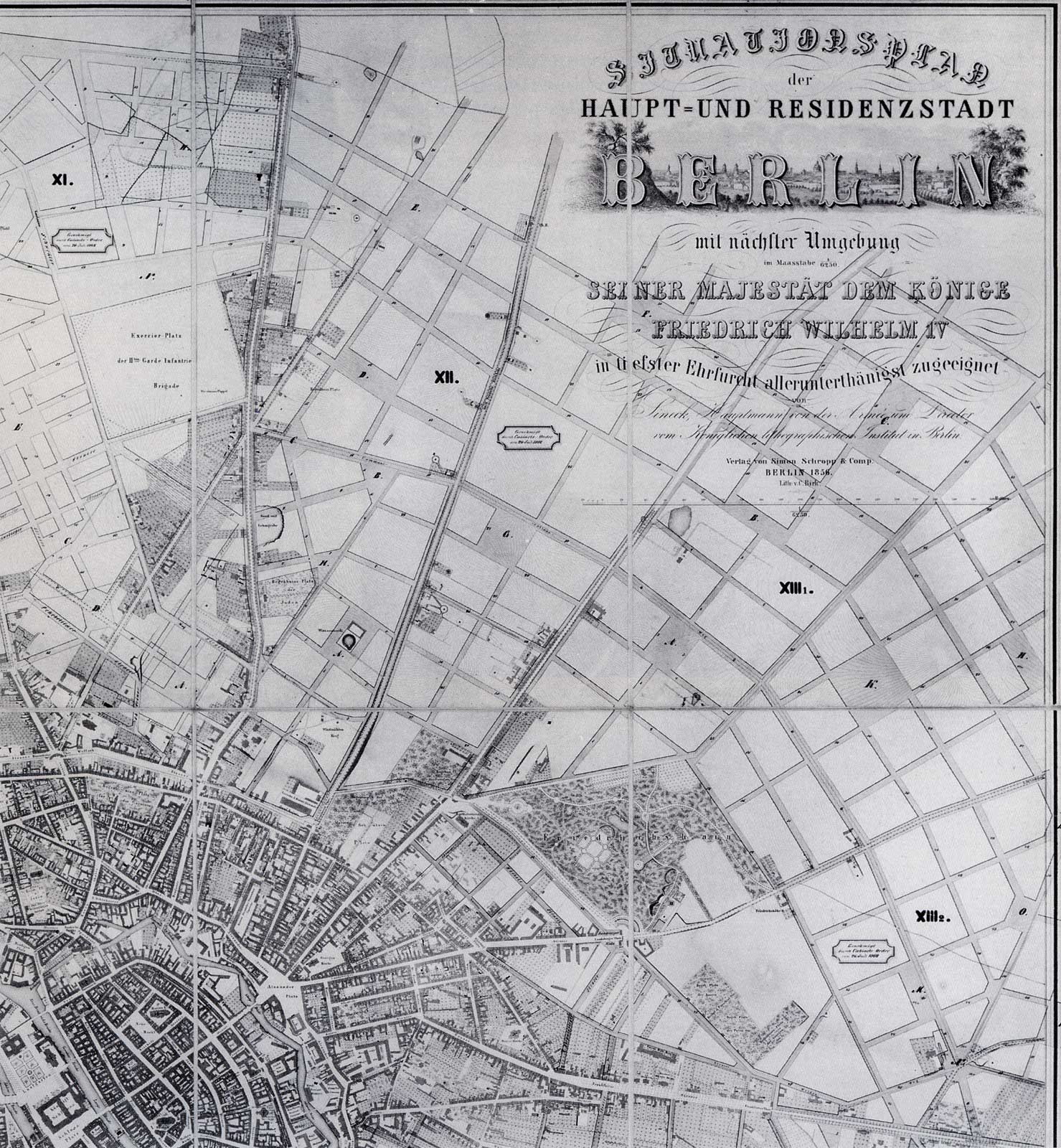
The Berlin city planner James Hobrecht, who played the role of Pierre L'Enfant, Andrew Haswell Green and Frederick Law Olmsted all rolled into one, had already distinguished himself from his counterparts in Washington and New York by incorporating existing roads into his plan, rather than blotting them out under an orthogonal grid.  His approach toward residential development, also, represented a quite different approach from the consensus emerging in mid-19th century London and New York, as this study describes:
"In a 1868 publication Hobrecht reveals his position on housing. He describes a situation in English cities where wealthy inhabitants would live in their villas in West-end districts. They would be completely separated - spatially and socially - from workers. Hobrecht rejects the English model with its strict spatial separation of classes on the scale of districts. Instead he illustrates the Berlin model, in which Mietskasernen play a crucial role. He describes the Mietskaserne as a multi-storey building with the following structure
of dwelling units and respective rent prices:
  • Floor IV: 3 units à 100 Taler
  • Floor III: 2 units à 150 Taler
  • Floor II: 3 units à 200 Taler
  • Floor I: 1 unit à 500 Taler
  • Ground floor: 2 units à 200 Taler
  • Basement or rear building: units à 50 Taler"
The study criticizes this arrangement for potentially exploiting the poor for rent, in substandard accommodations, and under the watchful eyes of the agents of the building owners and the wealthy residents on the étage noble, yet it's not clear, based on the facts given, whether the fourth floor or basement apartments actually paid for themselves (although it's said that the poorest residents often failed to pay their rent altogether).  Were the wealthier residents effectively subsidizing those in the basement and fourth floor?  Hobrecht's discussion of how he envisioned the residents living together, moreover, sounds like it was excerpted directly from The Death and Life of Great American Cities.

Berlin Mietskaserne.
As for the quality of the accommodations, Hobrecht's plans do concede a measure of comfort for the sake of affordability, a tradeoff which appears to reflect a market-based and realistic approach to affordable housing that contrasts with the garden city idealism of English and American planners.  Even so, certain pseudo-utilitarian fetishes of the day do make an appearance: an obsession with light and air, for one, excessively wide streets, and a requirement that courtyards be large enough for a fireman's wagon to make a u-turn.  Use-based zoning was absent, however, at least initially, with the buildings serving as residences, small-business incubators and manufactories all in one.

The study contrasts the positive and negative views of these apartments as being simultaneously "palaces" and "prisons", but even this dualistic interpretation contrasts with the almost uniformly negative appraisal of the tenements of Manhattan (although the tenants' own views probably differed from those of the most vocal critics).  Marc, in his comment, speculates that the design and quality of these dwellings may have played a role in the divergent attitudes of 19th century continental Europeans and Americans toward high-density living.  At the very least, this shows one alternative approach to planning, and to an integration of uses and incomes, that still has relevance for today's planners.

Wednesday, January 25, 2012

City Blocks: The Spaces In Between

A reader recently emailed me with an interesting question:
 "While I have a good sense of the design elements of the narrow street and attached housing for the front, I don't see much of what the back looks like.  Is it better to only have windows on one side and have a separate residence with another shared wall, This seems the most effective but do people want sunlight from both sides? Are they using private backyards, an alley, or both together? ... Are there shared courtyards and should these have grass? Isn't that similar to 'green space'.
The story of what has taken place in the spaces between blocks is an unexplored chapter of urban history. Every now and then particular episodes have been covered, with writers generally critiquing the process by which open space in block interiors yielded to new buildings.

Lewis Mumford in The City in History described, with disapproval, the process by which rear yards in medieval cities were filled in with houses and apartments as urbanization intensified in the late middle ages. Haussman has been criticized for permitting landlords to construct "airless and crowded tenements" behind the elegant street facades of new Parisian apartment buildings.  Others have lamented Barcelona's failure to maintain the interior of blocks in the Eixample as green space.  Even the modest concept of the mid-block laneway house has become a subject of controversy.

The process of block subdivision, infill and densification isn't an aberration, however, but instead represents the basic engine of urbanization in all times and places, at least where the process is not stunted or halted entirely by regulation.  It is more noticeable when it occurs in the context of an idealized plan, such as Haussman's for Paris or Cerda's for Barcelona, but the same process is at work in thousands of other less noteworthy cities.

A 1615 drawing of Paris shows the process well: the blocks outside the old city walls, to the left, are thinly lined with rowhouses backing onto ample gardens, while inside the wall, blocks once similar have been carved into much smaller pieces by narrow streets until, at farthest right, interior garden space has almost vanished.

To return to the question that was posed, what is happening to the interior of the blocks during this process?  In the unplanned city, the process of subdivision generally proceeded until an optimal ratio was struck between streets and accessible block space. Driving the process is the principle of maximization of land value, where a new street was justifiable only to the extent it increased adjacent land values in excess of the space lost to right of way, bearing in mind that ground floor, street-front rents are almost invariably command rents much higher than those on any other floor.

The result, in almost all cases, was a proliferation of small, or at least narrow blocks, generally not much more than 150 feet wide, and frequently a lot narrower.  The image below of Bordeaux shows the end result of this process, with the block partially outlined in yellow, for scale, measuring 115' by 380':


With blocks of this width, few apartments are entirely buried within block interiors, lacking street-facing windows or exits, while light shafts admit sunshine to inward-facing rooms. There are no rear alleys and no yards, yet most apartments do receive natural light from at least two directions.  Larger blocks frequently incorporate interior courtyards.

The same pattern can be imitated by planners, as in the case of Taipei, with the outlined block, one of the largest in this neighborhood, measuring only 75' by 200', with a small space left between back-to-back apartments.  Streets are generally about 16' wide, with wider arterials at intervals. The amount of street frontage within a five-minute walk of this block must be phenomenal, providing a resident with access to many dozens of businesses steps away from his front door.


Due land value gradients, block size in the unplanned city generally shrinks toward the center.  With planned cities, the opposite pattern is often seen, due to a tendency for grid-makers to overscale city blocks at the outset. leaving too much space too far from the street grid (a decision compensated for, in some places, by the introduction of alleys).  Mexico City and Salt Lake City were laid out centuries apart, but in both cases a clear transition toward much smaller blocks is evident beyond the original gridiron as the economic picture came into clearer focus and the benefits of narrower blocks became more evident: in Salt Lake City (below right), from 720'  to 380' square blocks, and in Mexico City from blocks 270' wide to 120' wide:


The dimensions for the Mexico City blocks closely approach those which Nathan Lewis has proposed in his writings: see How To Make a Pile of Dough with the Traditional City 5: The New New Suburbanism (scroll to the end for diagrams).  Blocks of this width can accommodate almost any type of structure with little wasted space: single-family homes with modest yards in Tokyo, rowhouses with small rear courts in Philadelphia, large apartment buildings in Barcelona.  Even skyscrapers are entirely possible.  At 200' feet and above, however, the width of the narrowest blocks in most American grids, even the largest townhouses struggle to fill up the space.

Ultimately, the question of what is going on between blocks depends in large degree on the size and shape of the blocks themselves, and that is a topic on which the experience of cities from around the world have a lot to teach us.

Related post:
Blocks of New York

Other discussions:
Why are Blocks that Size?
The Variety of American Grids

Friday, January 20, 2012

Friday Read: New York's Early Height Laws

In the past I've written about the effects of the design of New York's grid plan and particularly its division of blocks into lots of 25' by 100', dimensions that were, in the mid-19th century, incompatible with the construction of well-lit or ventilated apartment buildings. A 2003 paper published by the Cato Journal echoes these observations, but focuses on a less well-remembered aspect of New York's planning history: the building height act of 1885.

Although this law was overshadowed by the Tenement House Act of 1901 and even more so by the Zoning Resolution of 1916, the 1885 act established a precedent on building heights that would persist until the 1961 amendments to the New York zoning code and beyond.  The law, simple enough, capped building heights at 70 feet on narrower streets and 80 feet on the wide avenues – limits comparable to those found in European cities of the time – yet, unlike the laws of those cities, the New York ordinance only restricted residential buildings, leaving commercial structures, and hotels, unregulated.

The effects of this selective restriction are described:

"First, economic rents accrued immediately to owners of existing tall residential buildings due to the restriction of potential competition from the new buildings that would not now be built. …

"Second, developers of apartment buildings found themselves unable to compete with commercial-building interests for Manhattan building lots offering appeal either as residential or commercial sites. Prior to 1885, large apartment buildings had been constructed that not only competed with contemporary office buildings in their ground coverage but exceeded them in height.   This era now ended. …

"Finally, height restrictions helped prop up the tenement system by inhibiting the development of the tall apartment building as an indirect— and over time a direct—competitor. By preventing the development of tall residential buildings in Manhattan, height restrictions derailed a natural market process that would have lowered rents and increased quality beginning with the middle-class portion of the tenement market."
Although the law did not impose Euclidean zoning on the city, in effect the law zoned all buildings over the height limit as commercial, since these could no longer be converted to residential use.  In doing so, it anticipated the explicit zoning by use in the 1916 act.

The law also had long term implications for the arrangement of jobs and residences.  The observation that apartment buildings taller and larger than office buildings were beginning to appear in the city makes sense when we consider that office buildings have many more workers, per square foot, than apartment buildings have residents.  To fill the new office towers by pedestrian traffic would have required an even greater number of nearby residential towers.  With these prohibited, it would fall to mass transit to link the increasingly tall office buildings of lower Manhattan and Midtown with the residents of the six and seven story residential buildings spreading northwards up the island.

The strict height limits of the 1885 law were moderated somewhat in 1897, when New York moved to permit residential buildings of up to 12 stories on all streets.  This arrangement quickly gave way, in 1901, to the familiar "1 and 1/2" height formula, which restricted apartment buildings to the width of the adjacent street plus 50 percent.  It was this limit which was incorporated into the 1916 zoning resolution for residential areas, and which persisted for the most part until 1961, severely depressing the market for apartment construction in the city – with the exception of the avenues, where the formula yielded buildings of profitable dimensions (the claim of New York's planning department that the 1916 code could have accommodated 55 million seems questionable to say the least).

Perhaps the greatest irony of all is that the city's ultimate remedy for the so-called tenement problem – the form of the tenements and their persistence a direct consequence of city planning decisions dating back to 1811 – was to demolish tenement areas and replace them with high-rise apartments of the sort that the city had barred the private sector from building in the critical years from 1885 to 1930.  As New York reexamines its zoning code, will the city pause to consider its 200 years of planning history candidly and critically to see what lessons might be learned?

Related posts:
Blocks of New York
Living Space, Working Space and Centralization
Height Limits: The Forgotten Debates

Friday, January 13, 2012

Friday Read: Affordable Housing, Filtered, not Subsidized

Despite the enormous amount of attention that has been given to the subject of affordable housing in the recent past, and the wide array of programs and initiatives in response, including low income housing tax credits, inclusionary zoning and voucher programs, to name a few, there's been relatively little formal study made of filtering, the process in which housing gradually declines in relative price, and in rental value, as it ages. To fill this gap, economist Stuart Rosenthal has released a new paper in which he concludes that filtering, more so than many place-based subsidized housing programs, can provide a viable long-term source of low cost housing.

Using data from the American Housing Survey, and examining the income of owners and renters at various points in time, Rosenthal constructed charts showing the change in inflation-adjusted incomes of residents for homes of ages ranging from one to 86 years:


Based on the observed rates of downward filtering, which range from .5 percent per year for owner-occupied housing to 2.5 percent per year for rental housing, Rosenthal concluded that "policy makers should take seriously the market’s ability to generate lower income housing, and especially in the rental sector of the
market."  The study noted that differential rates of filtering by city and state also have implications for the efficient apportionment of federal housing money.

An interesting finding was that homes over 50 years old showed an increase in owner or renter income, even though the survivorship effect was controlled for by following individual houses over time.  Rosenthal hypothesized that older homes may have intrinsic structural qualities that make them more desirable to  buyers.

That hypothesis tracks my own finding which I discussed here, suggesting that the process of filtering, at least for initially high-income older neighborhoods, was a temporary result of rapid suburban dispersal in the 1940-1970 time period, and since that time has been steadily reversed.  On the other hand, some persistently disfavored quarters have remained poor throughout the 1940-2000 time period, showing little evidence of further decline or imminent gentrification.

Is filtering, then, partially an artifact of a temporary and unsustainable process of suburbanization, with gentrification representing a reversion to a pattern determined more by centrality of location and quality of housing stock or urban environment rather than size or newness of the home?  What that trend holds for the future of market-driven affordable housing is not entirely clear, although dire prognostications of coming suburban slums have appeared repeatedly in recent years.

One could hope that increased demand for existing urban neighborhoods might at least translate into a  process of steady upgrading and intensification of urban areas, yet the opposite seems to have occurred in most places, with residents holding fast to exclusionary zoning measures designed to impede new construction or conversion to higher value uses, even to the extent of zoning out larger single family homes.  The ultimate antidote to urbanism and densification, zoning, remains strong even nearing its 100th birthday.

Saturday, December 31, 2011

Exploring "The Greatest Grid"

The new exhibit "The Greatest Grid" at the Museum of the City of New York is well worth a visit for anyone with even a passing interest in urban planning or the history of the city.  An accompanying exhibit of speculative urban designs, however, provides evidence that the heroic materialist ideal has been slow to loosen its grasp over the minds of some practitioners in the fields of architecture and urban planning.

Simeon DeWitt's 1794 plan for Albany:
large blocks and wide streets.
Before featuring a few of these, though, a few words on the main exhibit.  Despite curator Hillary Ballon's evident admiration of New York's grid plan, the exhibit is evenhanded in its presentation, quoting liberally from critics such as Clement Clarke Moore (who famously quipped that the commissioners were "men who would have cut down the seven hills of Rome.")*  Not only the early 19th century era, but the entire subsequent century of growth and change is covered.  The featured historic maps and photos of the city are beautiful and fascinating.

There are also copies of the plans of other cities of the era, including L'Enfant's plan for Washington D.C. and (later commissioner) Simeon DeWitt's 1794 plan for a northern extension of Albany, which shows the same grid of oversized blocks and uniformly wide streets that would reappear a thousand times in the settlements of the following century.  The web of narrow streets and small blocks by the waterfront, a legacy of Dutch administration, was, as in New York, not eradicated, but evidently was not seen as an object of any interest, except as an example of a characteristics to be avoided.

Of particular interest to me were the photos of the shantytown settlements that occupied large parts of Manhattan through the end of the 19th century.  One interesting fact from the exhibit: Jacob Riis, the famous social reformer, opposed the eviction of shantytown inhabitants and the demolition of their dwellings, arguing that the self-built homes of the squatters provided accommodations superior to, and more affordable than, the tenements of the Lower East Side.

The partner exhibit, "The Unfinished Grid: Design Speculations for Manhattan", is interesting for somewhat different reasons: not so much for introducing viable design proposals for the city, but for shedding light on the imaginations of contemporarary architects and planners.  The proposals on display seem to draw from three basic sources of inspiration:
  • Heroic Materialism. This term, which I'm borrowing from Nathan Lewis (who in turn borrowed it from Kenneth Clark), describes an aesthetic preference for monumental scale and the image, as much as the reality, of technology and engineering prowess.  Nathan dates it to approximately 1780, although it has Baroque antecedents and yet truly came into its own only around 1900, when Western imaginations were already trending toward urban gigantism. It grew in influence in the 1920s and 1930s, with the ideas of Corbusier and other Modernists, and remained the dominant force in theoretical urban thinking at least through the 1960s (the suburban reality on the ground notwithstanding).
  • "Green" Urbanism.  Although this line of thinking was anticipated by the Broadacre City of Frank Lloyd Wright and the garden city movement, the current incarnation emphasizes an integration of natural forms, and especially agriculture, into urban areas, as well as sustainable building practices, without necessarily disparaging density.  Still, there is a degree of overlap with heroic materialism: "green" practices often rely on high-tech, rather than traditional technologies, while the tower-in-the-park form advocated by the Modernists, heroic materialist in scale, also reflects garden city influences.  Green projects can also be incremental, as below, but share a distinct focus that differentiates them.
  • Incremental Urbanism. Only two of the eight featured projects reflected this approach, which seeks to make more modest and gradual changes to the urban fabric, observing the city as it stands, reinforcing those qualities already found to be beneficial while addressing perceived shortcomings.  It is by far the most "Jacobsian" of the three, but also the least flashy, and least likely to lend itself to dramatic illustrations or other flights of visual fancy.
On to the exhibits:

Heroic Materialism: At left, giant skyscrapers dwarf the Empire State Building in a plan that called for zoning limits to be rescinded for all lots facing on north-south avenues (and presumed that developers would respond with towers obviously inspired by the Emerald City). At right is an architect's idea of some vast megastructure looming over the northern end of Central Park, with father and young son enjoying the park underneath projecting towers.

What about building 40-story towers on landfill sunk into the 50-foot deep waters of the Hudson river?  Cruise ships thread channels between buildings.


From a Green Urbanism perspective, why not tear up 71st street and replant it with wheat?  At least the streets would be car-free under this proposal, and the view is human-scaled and at street level.  More fundamentally, this proposal does recognize that the vast amount of Manhattan given over to wide surface streets represents a greatly under-exploited urban resource.


Tesselated housing in the sky -- they can't be serious, right?


Finally, 6 1/4 Avenue, by Ksestudio, which proposes opening a new 40-foot wide street between and parallel to 6th and 7th Avenues that, according to the designers, "activates the depth of the base of the New York tower by multiplying the public perimeter of the block."  Simple and elegant, simultaneously addressing the excessive width of the midtown blocks and the lack of additional north-south routes while greatly adding to the amount of accessible street frontage.  Feasible?  Maybe, maybe not, but the method is thoughtfully incremental.  No flashy graphics were included, just clear and concise figure-ground drawings.


That's all I have for 2011. See you in the new year!

*Stephen Smith has recently covered some other critiques of the plan here.

Friday, December 30, 2011

Downtown is for People

"It has sometimes been urged that this [low residential density in American cities] is largely the result of the development of the electric street railway in America, but the causal connection is not apparent. . . . It should rather be said that the American penchant for dwelling in cottage homes instead of business blocks after the fashion of Europe is the cause, and the trolley car the effect." -Adna Ferrin Weber, The Growth of Cities in the Nineteenth Century (1899).

"By the end of the [nineteenth] century, if not earlier, downtown was synonomous with the business district virtually everywhere in urban America. ... As well as a new word, "downtown" was, as Webster's noted, an American word.  It was virtually unknown in England and other Western European countries. Well into the early twentieth century English travel writers thought it necessary to explain the meaning of "down town" to their readers.  ... American reporters and public officials routinely refer to "downtown" in cities all over the world, but the word does not have much meaning outside the United States.  For downtown was not only an American word, it was also a uniquely American place." -Robert Fogelson, Downtown, Its Rise and Fall, 1880-1950 (2001).

The "penchant for dwelling in cottage homes":
"Sprawl" circa 1900, Rochester, NY.
As the excerpt from Adna Ferrin Weber's book shows, the study of suburban growth in America goes back much further than 2001's Suburban Nation, 1993's The Geography of Nowhere or 1985's Crabgrass Frontier.  A distinctively American pattern of low-density residential expansion in single-family detached homes was starting to be noticed by writers as early as the late 1800s.  Nearly 150 years earlier, a perceptive observer might have noted the significant differences between the small towns of Europe and those of North America, differences which portended the dominance of the "cottage home" in the United States, and Canada, in the centuries to come.

As Robert Fogelson points out, however, the existence of a small central district devoted to business and commerce was perceived as normative, rather than as a distinctively American feature.  Even today, of the hundreds or thousands of extant books and studies critiquing the form of American cities, the majority focus on suburban sprawl, with fewer specifically addressing downtown areas, much less critically.*

More typically, the 19th century commercial downtown is set up as an object of nostalgic admiration in spite of its generally unimpressive 20th century track record.  The reasons for its decline, whether absolute or relative, are not usually attributed to anything inherent in its conception or layout, but in the damaging acts done to it: among them freeway construction, urban renewal, street widening, and a rash of anti-urban regulations ranging from parking minimums to setback requirements. If downtown died, the cause was malpractice based on a faulty diagnosis, not any underlying illness.

Could it have been, though, that downtown was doomed to decline or stagnation from the start, at least in the form envisioned by 19th and early 20th century Americans?  The fundamental problem was this: for a large and growing city, continued high-density commercial growth in the center and omnipresent low-density residential growth elsewhere were ultimately incompatible.  Incompatible, because low-density growth required rapid outward expansion, and that same expansion carried increasingly large proportions of the urban population beyond a reasonable travel distance from the center, at least before the arrival of the automobile.

The story of downtown, as Fogelson tells it, is of increasingly desperate attempts by downtown merchants to fight the effects of this trend without sacrificing their monopoly on commercial space.  It was ultimately a losing battle, however, since the very transportation devices perceived by the commercial interests as great centralizers – the omnibus, the streetcar, and at last the automobile – were perhaps, as Weber observed, only symptoms of an epic decentralization. 

Each device, moreover, led inexorably to its successor: the omnibus and railroad carried the wealthy to outlying mansions, whose dispersal created a built-in market for speedier streetcar service; the streetcar suburbs, in turn, with their low-density and segregated uses, created a built-in market for the automobile. 

Transportation, in this view, was in the United States** often a lagging indicator of land use changes driven partly by personal preference, partly by increasing wealth, and partly by the sheer growth of urban populations and the arrival of heavy industry. The auto, at last, shattered the monopoly of fixed-route transportation lines and, by connection, the monopoly of downtown itself. 

The tendency, at this point, is to fault the automobile for the decline of downtown, as though a different approach to transportation policy in the critical years from 1890-1930 might have altered urban trajectories.  But this seems unlikely.  Fogelson describes how large and wealthy cities like Detroit and Cleveland did launch major, but ultimately failed, efforts to construct subways in the 1920s.  It could be said that Detroit was a city built around the automobile before the automobile existed.  Low-density, use-segregated, single-family detached homes on wide streets lent themselves to motorized personal transport much more than mass transit.  And once the car had arrived, why not simply move the department store, the supermarket, and even the workplace itself closer to one's residence? 

Downtown commercial interests, however, were convinced that downtown's problem was not its form and land use patterns, but in its lack of accessibility to shoppers and commuters.  The suburban preference, rightly or wrongly, was taken for granted in most places.  Once cars began to proliferate in the 1920s, the response was not, in most cases, to entice suburbanites with visions of urban living, but to either make valiant attempts at mass transit systems or, more often, to turn over large swathes of the downtown to the car.  As Norman Garrick and Chris McCahill have shown, this policy sometimes (as in the case of Hartford) resulted in an absolute decline in downtown jobs, indirectly assisting the ongoing decentralization of business.

Jane Jacobs knew better.  In the early days of urban renewal, and only two years after the passage of the Highway Act of 1956, she proclaimed in Fortune magazine that "Downtown is for People," by which she meant not only commuters and shoppers, but residents as well.  For decades her advice went unheeded, but it's still one of the best rallying cries out there for rethinking the American downtown.

*For just a small sampling, see Sprawl: A Compact History; Streetcar Suburbs; Crabgrass Frontier; Bourgeois Utopias; Suburban Nation; Building Suburbia; Geography of Nowhere.  Books focusing on downtown are much rarer: Fogelson's work and Alison Isenberg's Downtown America are the only general, book-length treatments I'm aware of, setting aside Death and Life, but if anyone knows of others I'd be glad to learn.

**Kenneth Jackson in Crabgrass Frontier describes how streetcars were generally much slower to catch on, and ridership lower, in European and Japanese cities, even though these were denser than the great majority of American cities.

Thursday, December 22, 2011

Roosevelt Island and Insular Urbanism

Stephen Smith and Cap'n Transit have been discussing the recent news that Cornell University-Technion-Israel Institute of Technology's graduate school of applied sciences will be constructed on New York City's Roosevelt Island, a 147-acre sliver of land set squarely in the middle of the East River. 

Although Stephen's article questions the wisdom of subsidizing physical expansion of the technology sector in poor and middle-class neighborhoods, both he and the Cap'n also critique the proposed design of the new campus (below), which Stephen has called "quasi-Corbusian:"  

The proposed plan, from the Cornell website.
Citing Nathan Lewis, Cap'n instead suggests a traditionally urban form incorporating "really narrow streets" for the new campus.  As it turns out, there are abundant examples of traditional urbanism on small or narrow islands that might serve as models, as pre-industrial cities often formed on or around mid-river islands for reasons of security or ease of transportation.

Here for instance is Paris' Île Saint-Louis, a 27-acre island only slightly narrower than Roosevelt Island.  Although no high rises are present, population density here is approximately 60,000 per square mile, with room to spare for modest but well-defined park space and a river promenade no more than one minute's walk away for any resident.


This is Chioggia, a canal town on the southern end of the Venetian lagoon which, although charming in its own right, is completely overshadowed by its famous northern neighbor.  I visited this town several years ago, and in spite of the extremely high ground coverage of buildings, there was no sense of claustrophobia.  The need for park space is reduced when the waterfront is so readily accessible.


Rhoda Island, adjoining central Cairo, has an evident early or mid-20th century plan in the garden city manner, with relatively wide streets on a modified grid.  Still, as virtually all buildings are mid-rise apartments, population density is very high. The Nile is no more than 500 feet away from any building.

For contrast, scroll back up to the proposed campus and compare the arrangements of space, the density of the built form, and the networks for pedestrian circulation.  Although the site claims that the primary building will be "the largest net-zero energy building in the eastern United States," there is nothing particularly green in underusing high-value urban land adjacent to mass transit.

The Cornell plan, rather than being a departure from current planning practice on the island, actually continues an ongoing trend away from more traditional forms.  The history of post-1950 urban development on Roosevelt Island is a interesting story in itself (for more see here and here), but at least at the outset, in the late 1960s and 1970s, planners conceived of a car-free haven densely built up with apartments. In spite of rather dismal architecture, the result (at right) was strikingly urban, and moreover achieved a sense of place through 1) keeping the street fairly narrow; 2) curving the street, creating visual enclosure; 3) slightly varying the angle at which buildings face the street to create gentle variations in right-of-way width; and 4) incorporating traditional city elements such as the covered arcade, at right.  The result, in spite of the architecture, is quite good, and it is probably no coincidence that the wikipedia page for the island features this very same perspective.

More recent developments have abandoned this approach, however.  Monolithic new apartment buildings to the south are placed in the middle of broad expanses of grass lawn in an approach far more reminiscent of 1960s tower-in-the-park urbanism than is the case for the older buildings to the north.  Rather than defining the street, these apartments are objects floating loosely in space, unrelated to each other or to the topography of the island.  An aerial view shows the extremely low footprint of these buildings – an extravagant use of land even by the standards of 1960s public housing – and their lack of engagement with the waterfront across the street.  Further, does this plan leave any room for future infill or expansion?  Most unbuilt land appears spoken for as roadway or dedicated park space.

If, on the other hand, builders and planners wish to provide a traditional urban environment, there are a multitude of successful examples waiting to serve as inspiration.  If not on a narrow island, with mass transit access, adjacent to Manhattan, then where?